Laura 5-Day Cone | August 25, 2020, 8am ET

Marco fizzles out, while Laura just gets started | CAT365

August 25, 2020 | Chad Trosper, BPMP

Share this Post

Marco has fizzled out and is expected to drift along the Louisiana coastline as rain. As for Laura, we could see a major hurricane develop pre-landfall.
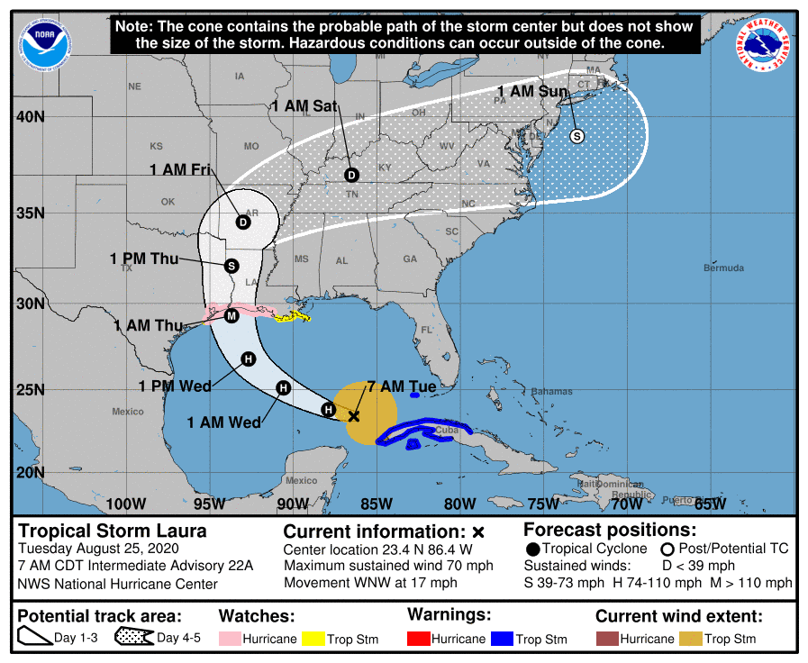
Marco has fizzled out and is expected to drift along the Louisiana coastline as rain. As for Laura, we could see a major hurricane develop pre-landfall.
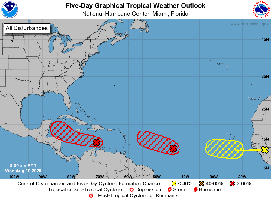
Five-Day Graphical Tropical Weather Outlook | August 19, 2020

And then there were three… | 19 Aug 2020 | CAT365

August 19, 2020 | Chad Trosper, BPMP

Share this Post

We now have three areas to watch over the next week or so.

We now have three areas to watch over the next week or so.

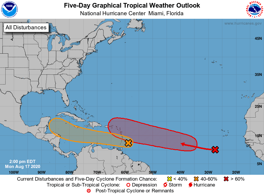
Five-Day Graphical Tropical Weather Outlook | August 17, 2020, 2:00pm ET

Two new waves in the Atlantic that need to be watched closely | CAT365

August 17, 2020 | Chad Trosper, BPMP

Share this Post

Given the waves’ placement and current track, we could see two systems in the Caribbean/Gulf by this weekend.

Given the waves’ placement and current track, we could see two systems in the Caribbean/Gulf by this weekend.

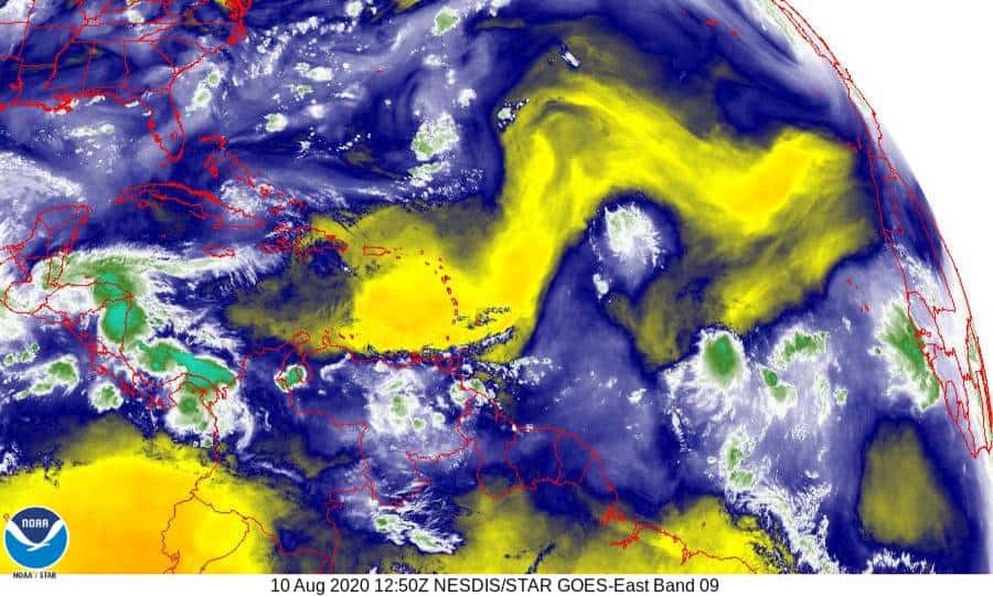
Band 9 - 6.9 µm - Mid-Level Water Vapor - IR - 10 Aug 2020 - 1250 UTC

We have a new Invest in the Atlantic | CAT365

August 10, 2020 | Chad Trosper, BPMP

Share this Post

After a quiet few days in the tropics, Invest 95 emerges with some chance of development.

After a quiet few days in the tropics, Invest 95 emerges with some chance of development.

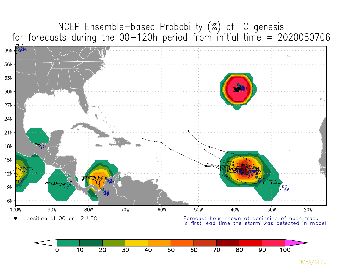
NCEP Ensemble-based Probability (%) of tropical cyclone genesis for forecasts during the 00-120h period | August 7, 2020, 6:00am

The tropics cool down, but expected to heat back up next week | CAT365

August 7, 2020 | Chad Trosper, BPMP

Share this Post

Well, it looks like we may get a well-deserved tropical break after our roller coaster of a storm Isaias.

Well, it looks like we may get a well-deserved tropical break after our roller coaster of a storm Isaias.

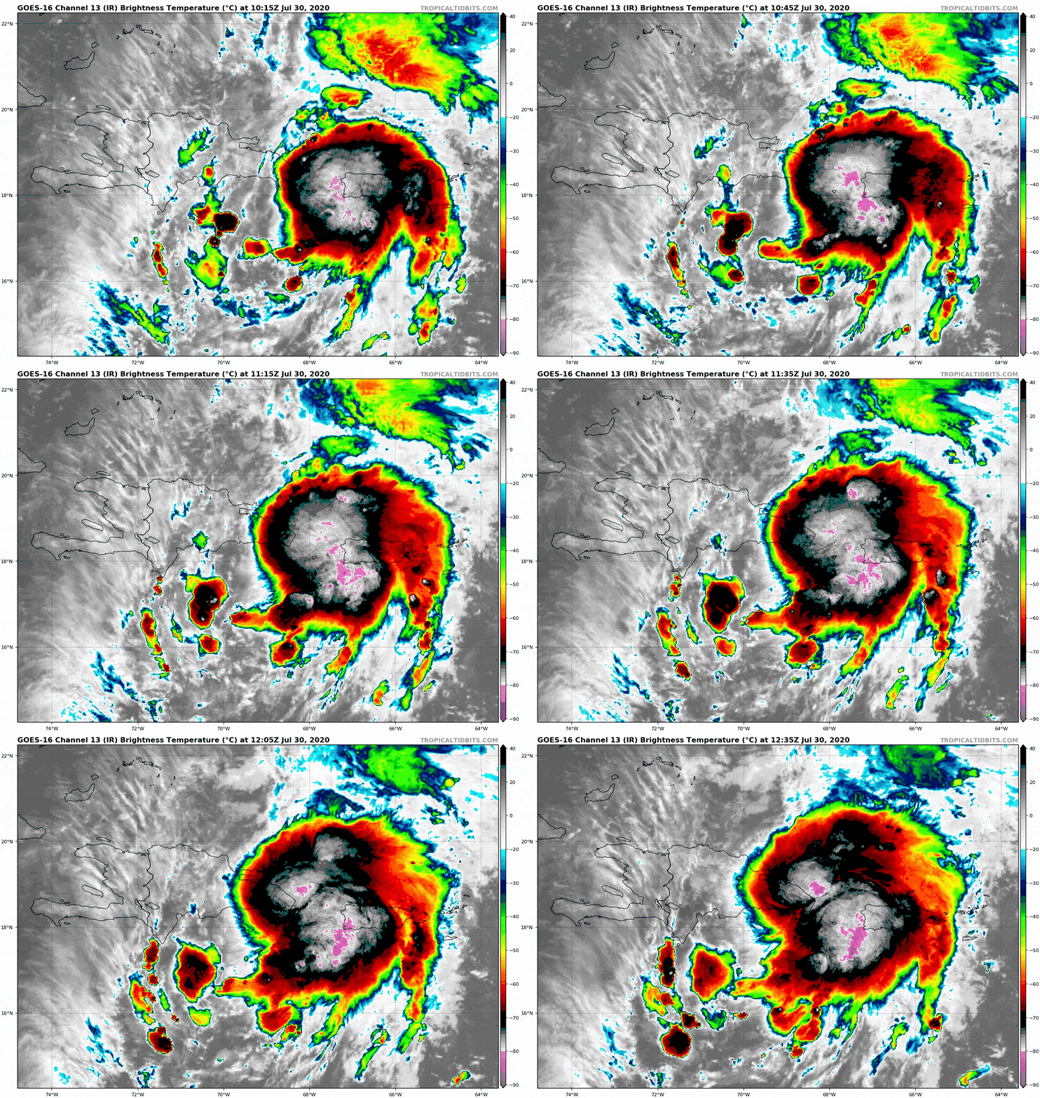
GOES-16 Channel 13 (IR) Brightness Temperature | July 30, 2020

We have our ninth named storm of 2020, “Isaias” | CAT365

July 30, 2020 | Chad Trosper, BPMP

Share this Post

Tropical Storm Isaias (ees-ah-EE-ahs) has formed in the Carribbean.

Tropical Storm Isaias (ees-ah-EE-ahs) has formed in the Carribbean.

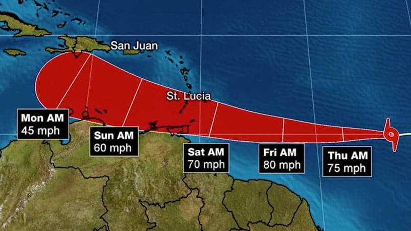
PTC 9 Potential Tracks | July 28, 2020

Potential Tropical Cyclone 9 forms in the Atlantic | CAT365

July 28, 2020 | Chad Trosper, BPMP

Share this Post

Invest 92 has been upgraded to a PTC (Potential Tropical Cyclone).

Invest 92 has been upgraded to a PTC (Potential Tropical Cyclone).

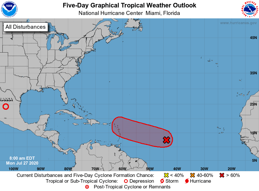
Five-Day Graphical Tropical Weather Outlook | July 27, 2020

And then there was one… | CAT 365

July 27, 2020 | Chad Trosper, BPMP

Share this Post

As Hanna moves inland, we turn our eyes to Invest 92 in the Atlantic.

As Hanna moves inland, we turn our eyes to Invest 92 in the Atlantic.

Tropical Storm Gonzalo Forecast | July 22, 2020

We have our seventh named storm of 2020 | CAT365

July 22, 2020 | Chad Trosper, BPMP

Share this Post

Gonzalo is the earliest ‘G’ storm on record.

Gonzalo is the earliest ‘G’ storm on record.

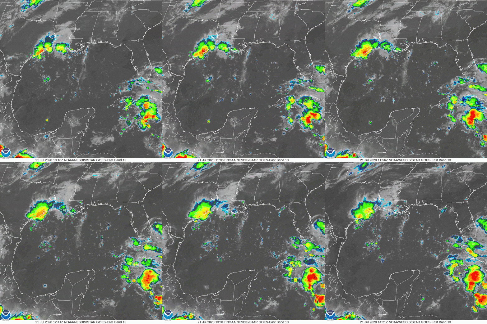
NOAA GOES-East Satellite | July 21, 2020

Tropics taking on a whole new tone this week | CAT365

July 21, 2020 | Chad Trosper, BPMP

Share this Post

Two systems show potential for development over the next few days.

Two systems show potential for development over the next few days.