Given the waves’ placement and current track, we could see two systems in the Caribbean/Gulf by this weekend.
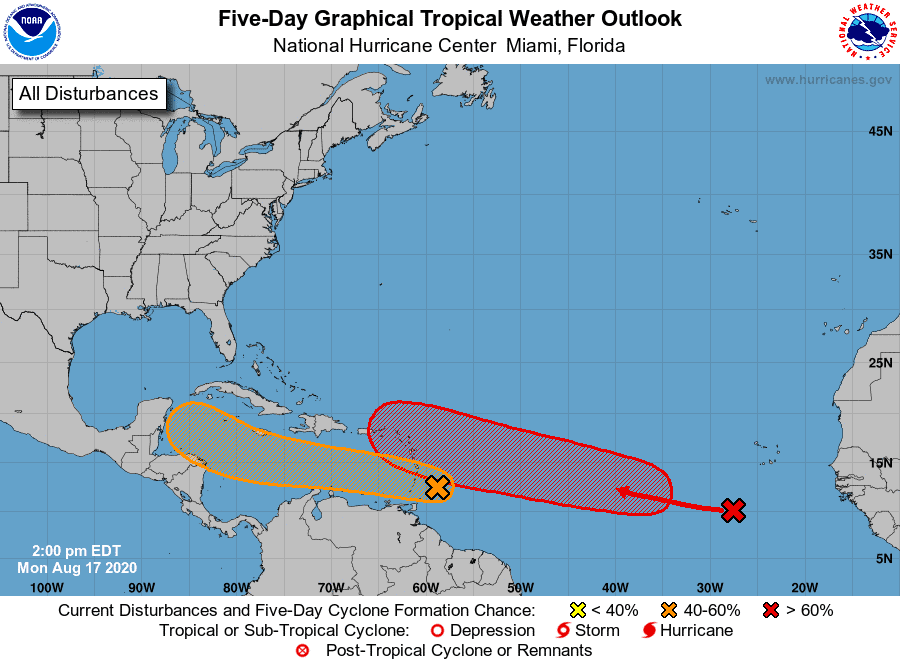
- We have two waves along the Main Development Region that need to be monitored closely.
- The first wave has been upgraded to Invest 97 and has a 50% chance of development.
- The second wave should be upgraded soon and has a 60% chance of development.
- Both waves are low riders and have the potential to travel further west into the Caribbean towards the Gulf.
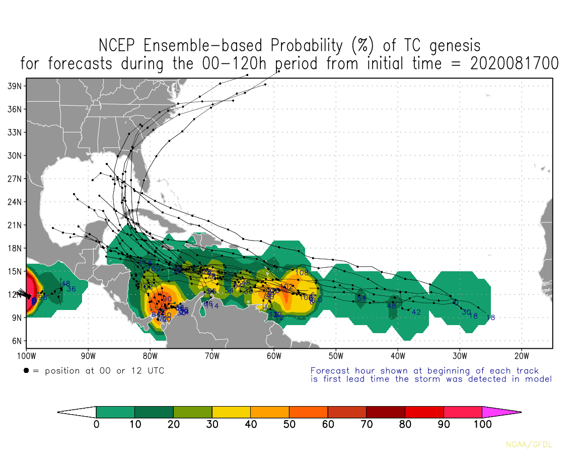
- Models are still back and forth on track since we are still >5 days out, but most track one or both into the Caribbean/Gulf vs pulling northward as we have seen with past systems.
- Given the waves’ placement and current track, we have the potential to see 2 possible systems in the Caribbean/Gulf by this weekend.
- These systems will be entering the Caribbean/Gulf around the same time as our MJO wave is expected. This could easily fuel these systems.
We ‘ll need to keep a close eye on both of these waves over the next 5-8 days. Lots to watch.

Chad Trosper is the AVP of Catastrophe Claims at Tower Hill Insurance. He has over 19 years of experience in the claims industry and a true passion for weather. Chad graduated from the University of Florida with a degree in Business and Sociology and also holds a master’s certification in Business Process Management from the University of San Francisco. Chad currently resides in Gainesville, Florida, with his wife and three children.