

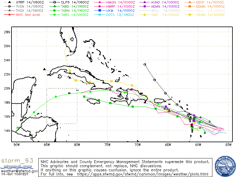
As for the Caribbean, we need to watch this area very closely next week. Models are showing potential for development early next week in the southeastern Caribbean. October is the month were we see big storms come out of the Caribbean, so this area is a hot spot for sure — same for the southeastern Atlantic near the Bahamas.
[/vc_column][/vc_row][vc_row padding_top=”0px” padding_bottom=”0px”][vc_column fade_animation_offset=”45px” width=”1/2″]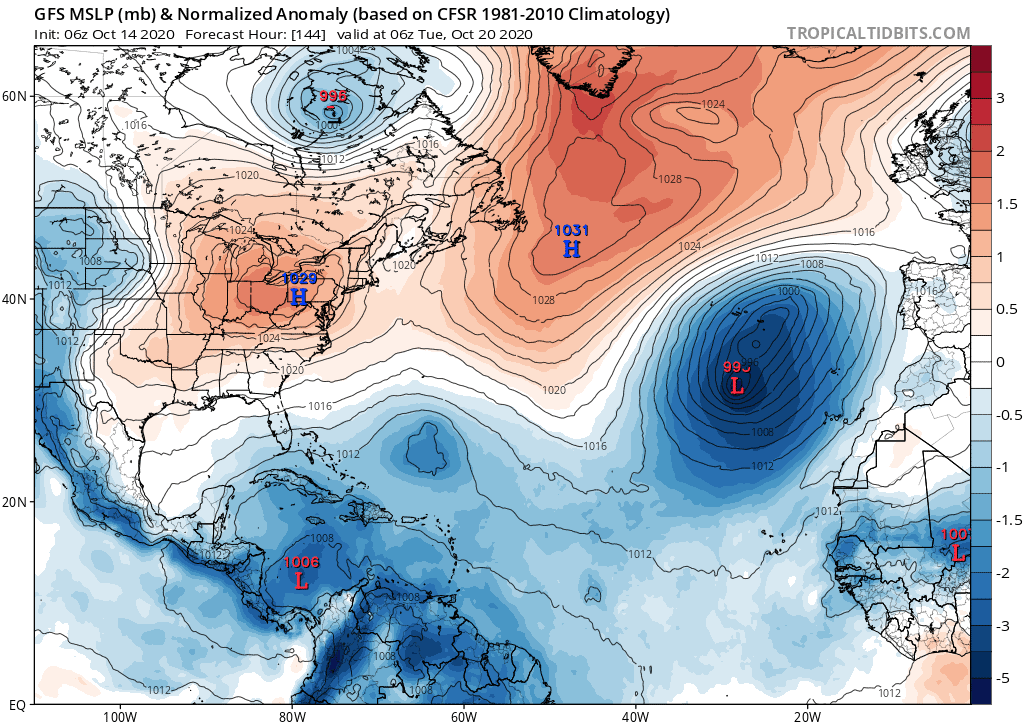


Chad Trosper is the AVP of Catastrophe Claims at Tower Hill Insurance. He has over 19 years of experience in the claims industry and a true passion for weather. Chad graduated from the University of Florida with a degree in Business and Sociology and also holds a master’s certification in Business Process Management from the University of San Francisco. Chad currently resides in Gainesville, Florida, with his wife and three children.