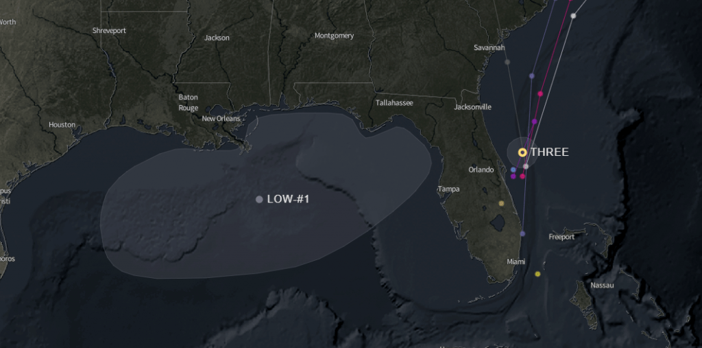
TD3 is moving fast and thankfully shouldn’t have much time to strengthen more before it’s pulled up and out to sea by a passing low later today or tomorrow. The East Coast should see mostly rain from this as most winds are on the east side of the system.
With that said, we have another yellow blob with a 20% chance of development over the next five days. This is some energy left from the passing low that is pushing TD3 out this week. Models are not forecasting much development for this system as it lingers in the Gulf and pulls eastward this week, possibly over Florida. Wind gusts (20 mph – 30 mph) could affect Central Florida and portions of South Florida tomorrow, but the system is expected to pass over quickly.
Again, as we saw with Invest 94, the conditions are there, so it’s worth watching.
Chad Trosper is the AVP of Catastrophe Claims at Tower Hill Insurance. He has over 19 years of experience in the claims industry and a true passion for weather. Chad graduated from the University of Florida with a degree in Business and Sociology and also holds a master’s certification in Business Process Management from the University of San Francisco. Chad currently resides in Gainesville, Florida, with his wife and three children.
