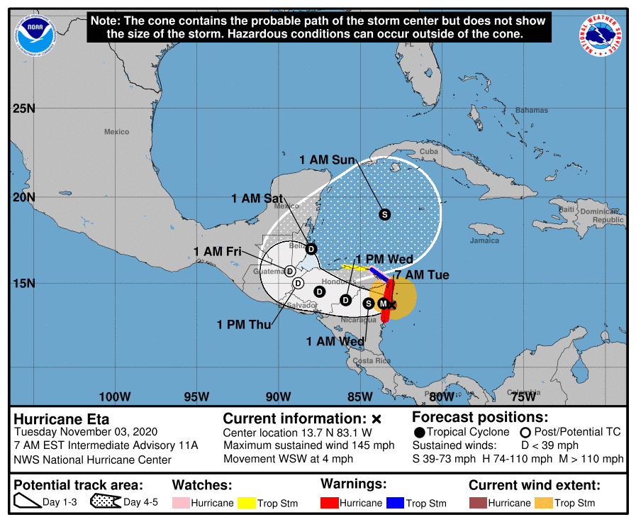
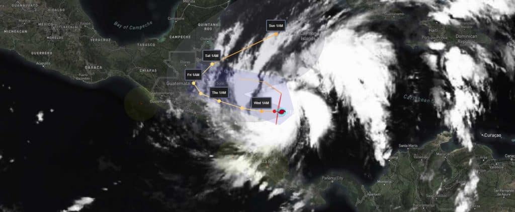
We could then see Eta push east and stall near Cuba due to blocking high pressure early next week. From there, we could either see Eta push back west, pull into the Gulf, approach South Florida, or even push up along the US East Coast.[/vc_column_text][/vc_column][/vc_row][vc_row padding_top=”0px” padding_bottom=”0px”][vc_column fade_animation_offset=”45px” width=”1/2″]
Lots at play, and timing is everything here.
All in all, the entire Gulf Coast should watch Eta closely. Especially Florida.
Chad Trosper is the AVP of Catastrophe Claims at Tower Hill Insurance. He has over 19 years of experience in the claims industry and a true passion for weather. Chad graduated from the University of Florida with a degree in Business and Sociology and also holds a master’s certification in Business Process Management from the University of San Francisco. Chad currently resides in Gainesville, Florida, with his wife and three children.
